PROJECT DESCRIPTION
The Illinois Department of Transportation (IDOT) and the Chicago Department of Transportation (CDOT) have begun a study to improve North Lake Shore Drive. The study encompasses the area between Grand Avenue and Hollywood Avenue along North Lake Shore Drive.
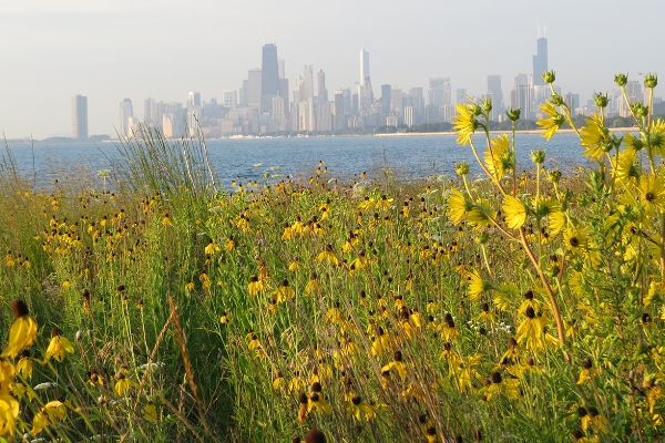
More than one hundred years ago, architect and planner Daniel Burnham inspired Chicago to “Make no little plans; they have no magic to stir men’s blood” and this grand vision inspired the public lakefront and Lake Shore Drive, which we enjoy today. The North Lake Shore Drive Study offers a rare opportunity to continue to enhance North Lake Shore Drive.
The project extends along North Shore Drive from Grand Avenue to Hollywood Avenue. Much of the infrastructure in this corridor was constructed in the 1930s through the WPA Program. Although the Drive has been repaired and resurfaced many times since initial construction, the bridges and appurtenances have reached the ends of their useful lives, and may warrant complete reconstruction or major rehabilitation.
The proposed project involves improvement of seven miles of the 8-lane Lake Shore Drive boulevard, including the 12 highway junctions. Junctions are those locations where major cross streets intersect Lake Shore Drive and access is allowed to and from the Outer Drive. The project will evaluate the condition of the 22 bridges and tunnels along the Outer Drive as well as the operation of the Inner Drive. To satisfy Complete Streets requirements the study will evaluate mobility and accessibility of non-motorized travel modes along the corridor.
To develop a successful plan to improve the Drive, it will require an extensive outreach program that generates creative community-based ideas that address user needs and respect the values and character of neighborhoods, yet fits within a complex implementation process. Achieving a balance between the original vision of a park boulevard and the realities of today’s travel demand will be critical.
The citizens of Chicago and all regional users will have the chance to provide input on how they use the Drive and how we can meet travel demands of all users in the corridor.
Help us redefine North Lake Shore Drive!
Virtual Community Meeting Information
The North Lake Shore Drive Phase I Study project team, in coordination with Alderman Tom Tunney of the 44th Ward and Alderman James Cappleman of the 46th Ward, invite you to attend a Virtual Community Meeting for the Lakeview area (Belmont Avenue to Addison Street)!
Date: June 22, 2021
Time: 6 p.m. to 8 p.m.
This meeting will be held virtually and a call-in option will also be available. Meeting materials, including a recorded presentation and interactive mapping tool will be available on this website in mid-June. If you register for the meeting, you will be notified when these materials are available. We look forward to seeing you on June 22!
We encourage you to submit questions below to be answered live at the Community Meeting!
Meeting Presentation
This presentation will focus on the NLSD Study area between Belmont Avenue and Addison Street. Community members will learn about recent input provided by the Lakeview community and view the latest proposed project designs.

Previous Meeting Materials
- Click here to review materials from the 2019 Diversey Parkway to Irving Park Road Community Meeting
- Click here to learn more about the Fall 2020 Public Input Opportunity
- Belmont/Lake Shore Drive Junction Base Alternatives
- Belmont Harbor Rendering
- Belmont Avenue Looking South Rendering
- Typical Pedestrian Underpass Rendering
PUBLIC INPUT OPPORTUNITY 2020 SEPTEMBER-NOVEMBER 2020
Thank you to all who participated in the North Lake Shore Drive Public Input Opportunity held September 28, 2020 through November 9, 2020! We welcome you to Review the meeting materials.
Below are documents specific to Lakeview and the 44th Ward:
CORRIDOR VISUALIZATIONS (CENTRAL)
CORRIDOR VISUALIZATIONS (TYPICAL SECTIONS)
PROPOSED DESIGNS FOR THE FIVE ALTERNATIVES TO BE CARRIED FORWARD TO LEVEL 3 SCREENING:
“THE ESSENTIAL”
TRANSIT PRIORITY – JUNCTIONS
(CONTEXT TAILORED TREATMENTS WITH TRANSIT ADVANTAGES – CTT+TA)
“THE ADDITION”
TRANSIT PRIORITY – EXCLUSIVE
(DEDICATED TRANSITWAY-LEFT – DTW-L)
“THE EXCHANGE”
TRANSIT PRIORITY – EXCLUSIVE
(3+1 BUS ONLY LANE – 3+1 BOL)
“THE FLEX”
TRANSIT PRIORITY – SHARED
(3+1 MANAGED LANE – 3+1 ML)
“THE DOUBLE FLEX”
TRANSIT PRIORITY – SHARED
(2+2 MANAGED LANES – 2+2 ML)
ADDITIONAL PLANS AND INFORMATION COMMON TO ALL ALTERNATIVES:
SHORELINE PROTECTION
NORTHERN TERMINUS TRAFFIC STUDY
STUDY BACKGROUND
EXISTING CONDITIONS
North Lake Shore Drive Study Spotlights
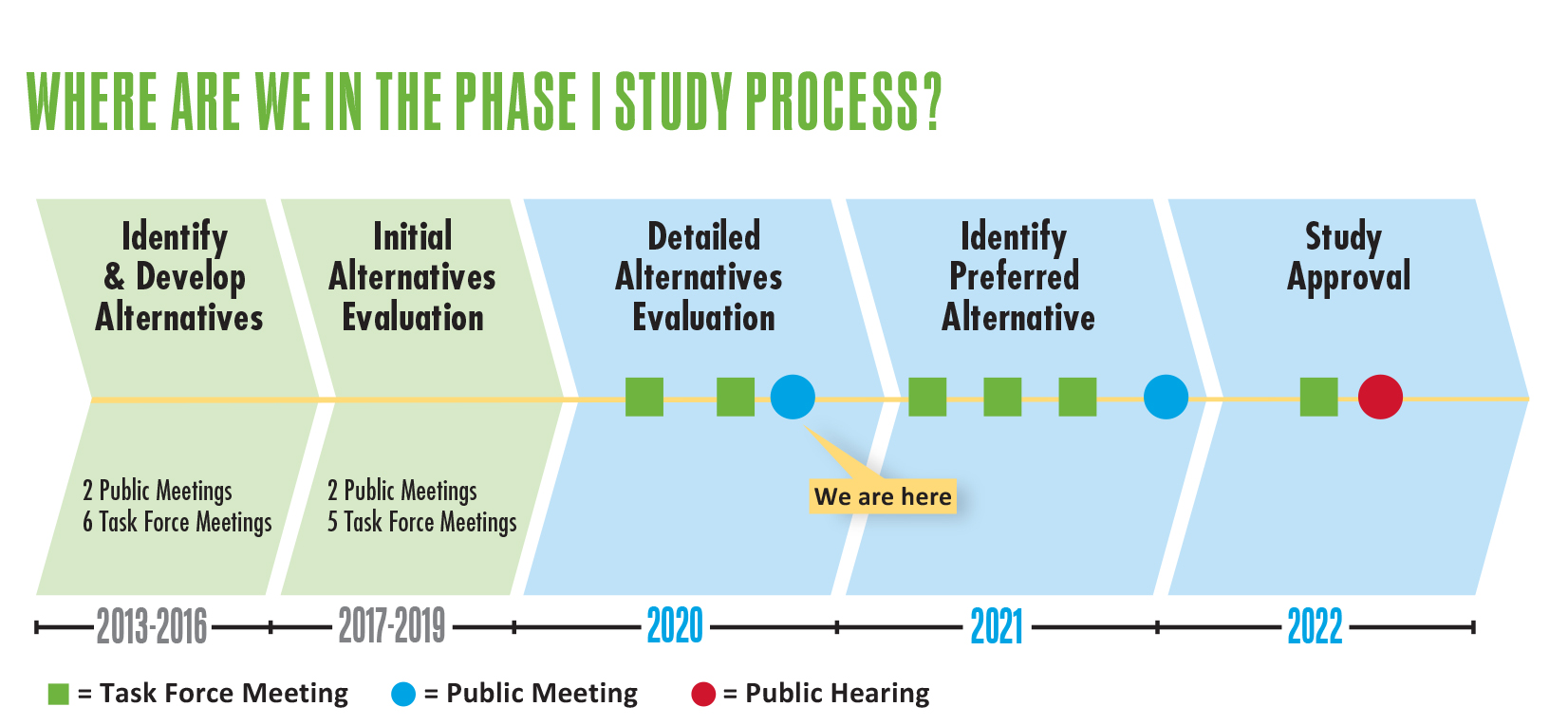
The North Lake Shore Drive project team has reached a critical milestone in the study process as we prepare to recommend a narrowed range of alternatives to be carried forward to the next stage of analysis. In preparation for this next step, we are summarizing basic information that will explain the project in more detail as well as highlighting some key improvements that will be common to all alternatives. This information is being shared in several Study Spotlights, each focusing on a specific topic.
- North Lake Shore Drive Study Spotlights: Purpose and Need & Public Outreach Efforts
The Purpose and Need was developed and agreed upon through extensive collaboration with stakeholders when the study first began. This statement defines the study’s goals and forms the basis upon which all alternatives have so far been measured. The Purpose and Need is continuously called upon throughout the project process when developing and evaluating proposed design improvements.
- North Lake Shore Drive Study Spotlights: Transit Improvements
The study’s Purpose and Need calls for improving safety and mobility for all users, improving infrastructure deficiencies and improving access and circulation throughout the project corridor. To accomplish these goals, targeted transit improvements are a key component of the project scope. Review the transit improvements common to all alternatives in this Study Spotlight.
- North Lake Shore Drive Study Spotlights: Environment and Climate Change
As the North Lake Shore Drive corridor continues to experience the effects of climate change, the NLSD Phase I Study project team remains committed to developing designs and improvements to mitigate and adapt to these impacts. Review these proposed designs and improvements in this Study Spotlight.
- North Lake Shore Drive Study Spotlights: Lakefront Trail and Park Access
Since the last public meeting, the project team has continued to develop design concepts for the Lakefront Trail and park access to enhance the experience for all users. Review these design concepts, goals and visual renderings in the Study Spotlight.
If you have comments on the information above, or on any other project materials, please use the online comment form to provide input: https://www.NorthLakeShoreDrive.org.
DIVERSEY PARKWAY TO IRVING PARK ROAD CORRIDOR
SUBMITTED COMMENTS
- Lakeview_Community_Meeting_Comments_-_Temple_Sholom_August_12
- Lakeview_Community_Meeting_Comments_-_St._Josephs_Hospital_August_13
DIVERSEY PARKWAY TO IRVING PARK ROAD CORRIDOR
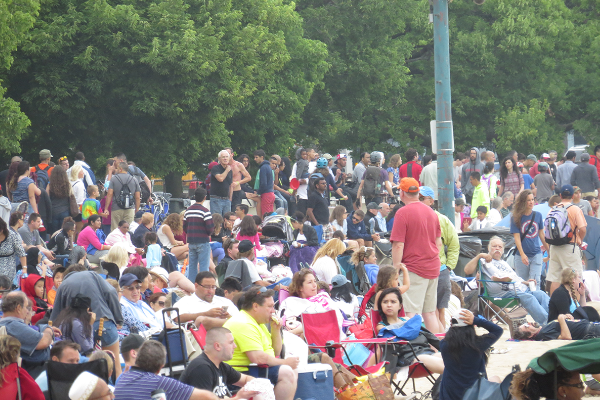
Alderman Lawson of the 44th Ward hosted two Community Meetings focused on the Diversey Parkway to Irving Park Road segment within the North Lake Shore Drive (NLSD) project area. The goal of these meetings was to receive direct community input on the potential improvements within this area.
The two Community Meetings were held on August 12, 2019 and August 13, 2019. The first meeting took place at Temple Sholom in the Bettie Porter Hall from 6:30 p.m. to 8:30 p.m. and over 100 members of the public attended. The second meeting took place at AMITA Health Saint Joseph Hospital in the Lakeshore Café from 6 p.m. to 8 p.m. and over 130 members of the public attended. The agendas, formats, and presentation materials of both meetings were identical. The meetings were held in an open house format with a PowerPoint presentation including an open Q&A, followed by smaller breakout group discussions with project team members. Exhibits displaying the Diversey Parkway to Irving Park Road Corridor Context Tailored Treatment Alternative were reviewed during these small group discussions and feedback was provided. Comments will continue to be accepted through the entire project development process. However, to become part of the public record specific to these Community Meetings, comments must be received or postmarked by August 30, 2019.
Materials presented at the Community Meeting can be found below:
- PowerPoint Presentation (pdf)
EXHIBITS (pdf)
- EXISTING CONDITIONS – 2013 AVERAGE DAILY TRAFFIC VOLUMES
- EXISTING CONDITIONS – 2011 TO 2014 AUTOMOBILE CRASH DATA
- EXISTING CONDITIONS – 2013 LAKEFRONT TRAIL USER VOLUMES
- TOP PERFORMING CONTEXT TAILORED TREATMENT ALTERNATIVE: GRAND AVE TO DIVERSEY PKWY
- TOP PERFORMING CONTEXT TAILORED TREATMENT ALTERNATIVE: DIVERSEY PKWY TO MONTROSE AVE
- TOP PERFORMING CONTEXT TAILORED TREATMENT ALTERNATIVE: MONTROSE AVE TO HOLLYWOOD AVE
Strong public involvement is a critical element of this study. Please review each section of Get Involved to learn more about the NLSD Phase I Study’s Stakeholder Involvement Plan, the Context Sensitive Solutions (CSS) design process, the Project’s Task Forces, and previous and upcoming Public Meetings.
In coordination with local aldermen, the project team is supporting numerous community meetings throughout the corridor. These community meetings are focusing on the proposed Context Tailored Treatment Alternatives designs within specific sections of the corridor. These smaller, more focused meetings offer an additional opportunity for community members to provide their feedback directly to the project team. Meeting summaries and materials can be found through the links below.
If you are interested in submitting a comment, CLICK HERE.
Send an email to info@northlakeshoredrive.org if you would like to receive the e-newsletters.
The Illinois Department of Transportation (IDOT) and the Chicago Department of Transportation (CDOT) have begun a study to improve North Lake Shore Drive. The study encompasses the area between Grand Avenue and Hollywood Avenue along North Lake Shore Drive.
More than one hundred years ago, architect and planner Daniel Burnham inspired Chicago to “Make no little plans; they have no magic to stir men’s blood” and this grand vision inspired the public lakefront and Lake Shore Drive, which we enjoy today. The North Lake Shore Drive Study offers a rare opportunity to continue to enhance North Lake Shore Drive.
The citizens of Chicago and all regional users will have the chance to provide input on how they use the Drive and how we can meet travel demands of all users in the corridor.
Help us redefine North Lake Shore Drive!
Latest News
IDOT Secretary Randy Blankenhorn Introduces the North Lake Shore Drive Project at Public Meeting #3
Latest Update
JULY 2018
Task Force Meeting #9 – Review the meeting materials
MARCH 2018
Task Force Meeting #8 – Review the meeting materials
NOVEMBER 2017
Public Meeting #3 Survey – View survey results
OCTOBER 2017
Task Force Meeting #7 – Review the meeting materials
JULY 2017
Public Meeting #3 – Review the meeting materials
MAY 2017
Task Force Meeting #6 – Review the meeting materials
DECEMBER 2016
Task Force Meeting #5 – Review the meeting materials
MAY 2015
Since the NLSD Phase I kickoff in 2013, numerous meetings have been held with the public, existing conditions and transportation needs have been identified, and the Purpose and Need Statement has been drafted and approved. The Project Study Group, consisting of the Illinois Department of Transportation (IDOT), Chicago Department of Transportation (CDOT), the Federal Highway Administration (FHWA), the Chicago Park District and the Chicago Transit Authority (CTA) is now in the process of identifying, developing and evaluating alternatives.
Please take a moment to read the NLSD Spring 2015 Newsletter for more information about What’s Next, Alternatives Development & Evaluation, the public’s Top 20 Ideas to Redefine the Drive, Coastal Considerations and more.
DECEMBER 2014
View the current Purpose & Need Statement (PDF 9MB)
We are pleased to announce that we have recently received concurrence on the project’s Purpose & Need Statement from all of the necessary regulatory and resource agencies. This includes the U.S. Environmental Protection Agency (EPA), U.S. Fish and Wildlife Service and the U.S. Army Corps of Engineers.
The North Lake Shore Drive Purpose & Need Statement has changed since it was posted in May of 2014. Project stakeholders have provided extensive and valuable input that has allowed the Project Study Group to enhance the draft Purpose & Need Statement and better focus it on the diverse needs that exist in the project area. Since the draft Purpose & Need Statement was posted, the project team has reviewed your feedback, made revisions to the document and sought concurrence on the revised document from regulatory and resource agencies that are partners in the NEPA/404 Merger process.
The current Purpose and Need Statement documents the following needs:
- Improve safety for all users.
- Improve mobility for all users.
- Address infrastructure deficiencies.
- Improve access and circulation.
This document will guide development of the project alternatives and, eventually, the preferred alternative. You can also review the list of regulatory and resource agencies in the Stakeholder Involvement Plan.
The Purpose & Need Statement for a project is essential to establishing a basis for the development of the range of reasonable alternatives required in an Environmental Impact Statement (EIS) and assists with the identification and eventual selection of a preferred alternative. It is also an important first step in the NEPA/404 Merger Process which ultimately will assure that all applicable environmental laws, executive orders, and regulations are considered and addressed prior to the final project decision and document approval. The Merger Process allows transportation officials to make project decisions that balance engineering and transportation needs with social, economic, and natural environmental factors.
Please note that the Project Study Group has reviewed all of the improvement ideas and suggestions that we received from stakeholders and the public. We are using that data to develop a wide range of improvement concepts for the study corridor. In addition, we are formulating the criteria that will be used to evaluate the alternatives.
To learn more about the EIS process and Purpose & Need Statement you can review these materials: The Importance of Purpose & Need Statement in Environmental Documents,Task Force Meeting #2 Presentation, or the Public Meeting #1 presentation.
OCTOBER 2014
Top 20 Ideas to Redefine the Drive – View the PDF
JULY 2014
Public Meeting #2 – Public meeting materials
MAY 2014
DRAFT PURPOSE & NEED STATEMENT (PDF)
MARCH 2014
Task Force Meeting #4 – Review the meeting materials
AUGUST 2013
Public Meeting #1 – Public meeting materials
PHOTO GALLERY
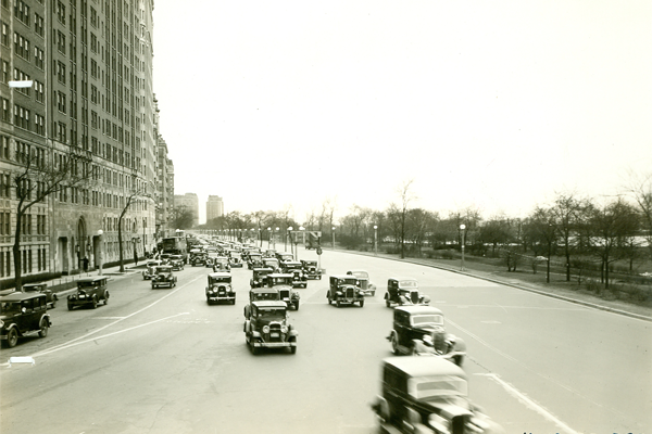
1935 - Looking north along Lake Shore Drive at Belmont Avenue © Chicago Park District Special Collections
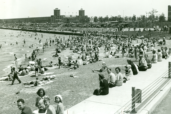
1930s - Ohio Street Beach © Chicago Park District Special Collections
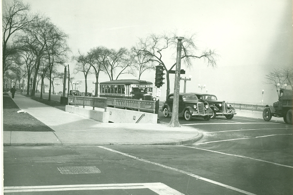
1937 - Division Street Pedestrian Underpass Entrance © Chicago Park District Special Collections
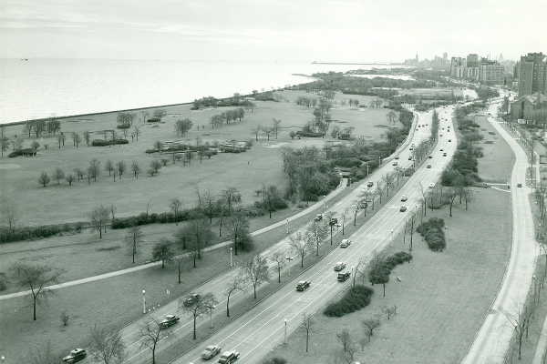
1942 - Looking south along Lake Shore Drive at Belmont Avenue © Chicago Park District Special Collections
1945 - Lincoln Park Extension-Waveland Golf Course Looking South © Chicago Park District Special Collections
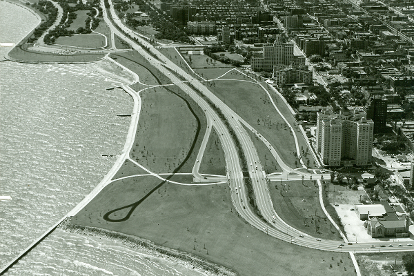
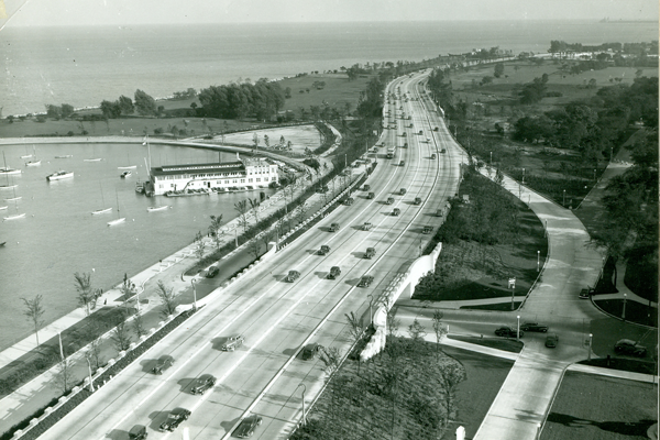
1958 - Lincoln Park Extension-Foster to Hollywood Aerial Looking South © Chicago Park District Special Collections
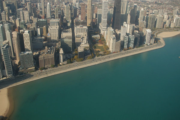
2009 - Aerial view looking west near Navy Pier © Photography by Brian Fritz
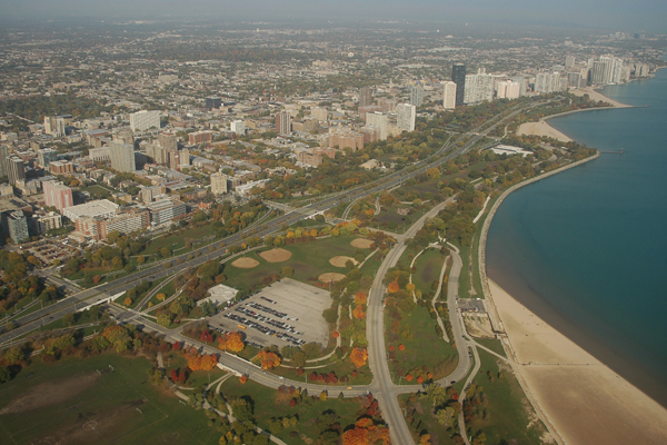
2009 - Aerial view looking northwest near Montrose Avenue © Photography by Brian Fritz
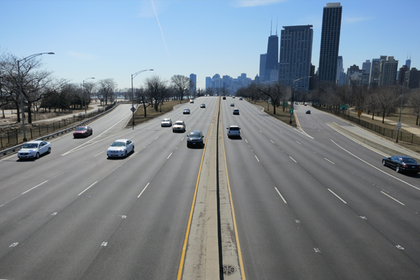
2012 - Looking south from the Passerelle Bridge north of LaSalle Drive
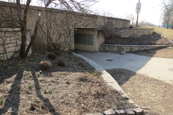
2012 - Looking southeast at Buena Avenue pedestrian underpass
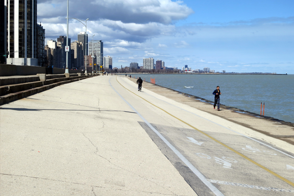
2012 - Looking north along Lakefront Trail at Chicago Avenue
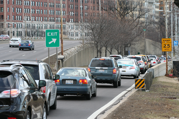
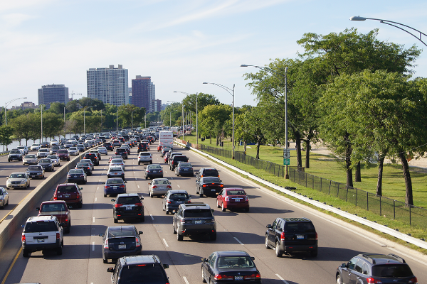
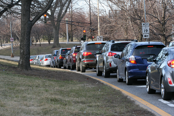
2013 - Northbound Belmont Avenue exit ramp during evening rush hour.
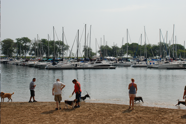
2014 - Belmont Harbor Dog Beach
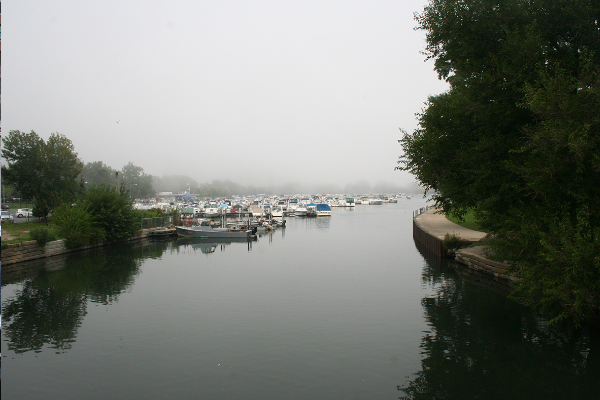
2014 - Diversy Harbor - On Fullerton Looking North

2014 - Divvy Bike Station - Michigan and Oak
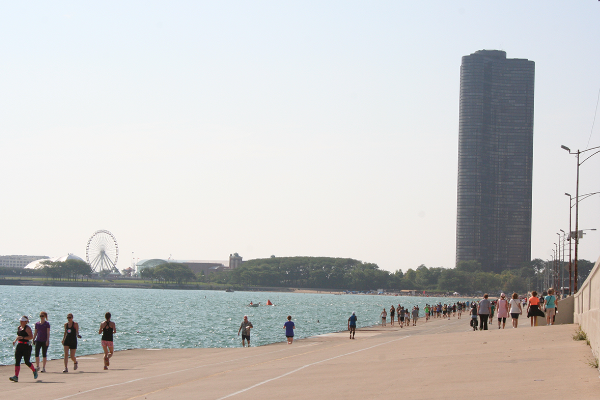
2014 - Lakefront Path at Oak Street Curve looking South
2014 - Looking North from Passerelle Bridge
2014 - Montrose Point Scenic View
2014 - Oak Street Beach Air and Water Show Crowd
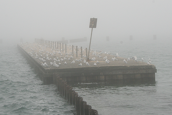
2014 - Seagulls on pier near Fullerton
2014 - NB Exit traffic at Irving Park